

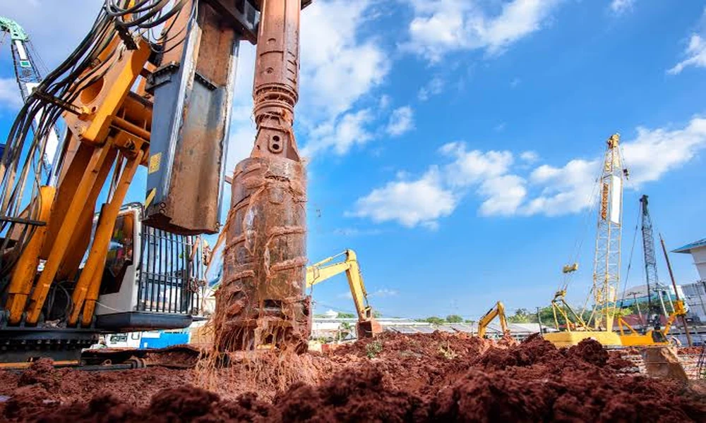
Ground conditions can decide whether an overseas government facility stays on budget or develops structural problems. A geotechnical risk assessment examines soil, rock, water, slopes, seismic forces, and construction access before design is fixed. That work gives agencies a basis for foundations, drainage, schedules, and long-term maintenance abroad.
What Lies Beneath the Site Changes the Entire Design
Subsurface investigations begin with borings, test pits, sampling, and field measurements across the footprint. Engineers use those results to identify soil layers, rock depth, groundwater, fill material, and weak zones hidden from surface view. Sparse testing may miss buried channels or soft pockets that later cause settlement.
Laboratory testing adds detail by measuring strength, density, moisture response, plasticity, and chemical content. Results help designers estimate how the ground will behave under buildings, roads, tanks, walls, and heavy equipment. Planning through Navigator International Government construction can connect these findings with the mission, site layout, and field methods.
Regional records also matter because a single investigation captures conditions only at selected points. Historic maps, boreholes, flood records, mining activity, and local construction experience can reveal wider patterns. Combined evidence gives the design team a stronger model of the ground than isolated samples alone.
Foundation Choices Must Match Soil Behavior and Mission Loads
Shallow footings work well where firm soil sits close to the surface and settlement remains within acceptable limits. Weak deposits may require mats, piles, drilled shafts, soil replacement, or ground improvement. Selection depends on structural loads, equipment vibration, groundwater, construction access, and the consequences of uneven movement.
Sensitive government facilities often demand tighter settlement control than ordinary buildings. Communications rooms, secure doors, precision equipment, utility connections, and protective systems may perform poorly even when the main frame remains safe. Specialists therefore study total settlement and differences between adjoining foundations.
Practicality influences the recommendation. Remote areas may lack large piling rigs, specialty grout, or experienced installers, making a sound option difficult to build. Support from Navigator International Global Construction can align engineering choices with regional labor, supply, transport, and inspection capacity.
Groundwater Can Disrupt Both Construction and Operations
High groundwater complicates excavation, concrete placement, utility work, and slope stability. Pumping may lower water temporarily, yet uncontrolled dewatering can draw fine soil into an excavation or cause nearby ground to settle. Monitoring wells help teams track water levels during fieldwork.
Permanent design must address uplift, seepage, corrosion, and water pressure around buried structures. Drainage blankets, waterproofing, cutoffs, sumps, and relief systems may be needed to protect basements or utility corridors. Climate cycles deserve attention because water levels can rise sharply during wet seasons.
Discharge rules can also affect the schedule. Pumped water may require testing, treatment, permits, or controlled disposal before discharge. Nav Int coordination can connect environmental duties with excavation planning so groundwater controls remain compliant and workable.
Seismic and Slope Hazards Require Site-Specific Study
Earthquake risk involves more than selecting a code value from a regional map. Analysts examine soil amplification, fault proximity, liquefaction, lateral spreading, and the stability of retaining systems. Loose saturated soils may lose strength during shaking and damage foundations, roads, or buried utilities.
Sloping sites introduce concerns involving landslides, erosion, rockfall, and deep movement along weak layers. Cut-and-fill operations can disturb an apparently stable hillside by changing drainage or removing support. Instrumentation may track movement at high-risk sites.
Protective measures can include soil densification, anchors, piles, retaining structures, drainage, or revised building placement. International government construction teams should compare the cost of these controls with alternate layouts or sites before approving major stabilization.
Construction Methods Need Their Own Geotechnical Controls
Temporary conditions can be more hazardous than the finished structure. Open excavations, stockpiles, cranes, haul roads, and partially completed fills place short-term loads on soil that designers must consider. Daily weather changes may further weaken access routes or excavation faces.
Field quality testing confirms whether earthwork matches the design assumptions. Density tests, moisture checks, proof rolling, pile records, and concrete logs provide evidence that crews prepared the ground correctly. Global construction programs benefit from consistent testing procedures across locations with different practices.
Unexpected conditions require a response path. Crews should stop, document the area, protect the work, and obtain engineering direction before covering weak soil or altering foundations. Reporting reduces delay without allowing improvised fixes to become permanent risks.
Long-Term Monitoring Protects the Facility After Turnover
Geotechnical performance continues after construction as fills settle, drainage systems age, and groundwater patterns change. Survey points, crack gauges, piezometers, or slope instruments can show whether movement remains within expected limits. Early warning allows maintenance teams to respond before damage spreads.
Asset records should preserve boring logs, test results, foundation drawings, instrumentation readings, and repair history. Future renovation teams need that information when adding equipment, expanding buildings, or changing drainage. Capabilities from Navigator International Construction Company can link design, construction, logistics, quality control, and turnover records.
Ultimately, sound ground decisions support structures, stable pavements, reliable utilities, and realistic maintenance budgets. For government customers, Navigator International can coordinate geotechnical findings with site planning, engineering, procurement, and construction, giving overseas facilities a stronger foundation for dependable service.